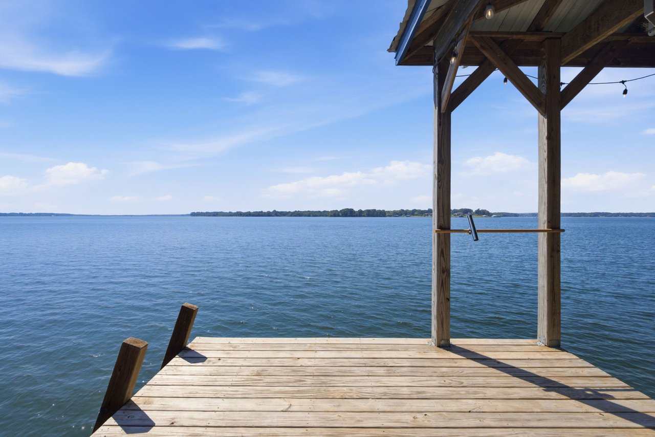
This fall, the walk from the back porch to the dock is longer on most Lake Fork lots. On October 30, 2026, the Texas Water Development Board's Water Data for Texas had the reservoir at 79.3% full, with an average level of 397.93 feet. That is about five feet under the 403-foot conservation pool the lake is managed to hold. Over the past year the lake's surface shrank from 24,945 acres to 23,079, so close to 1,900 acres of former lake bottom are now bank, mud and stumps.
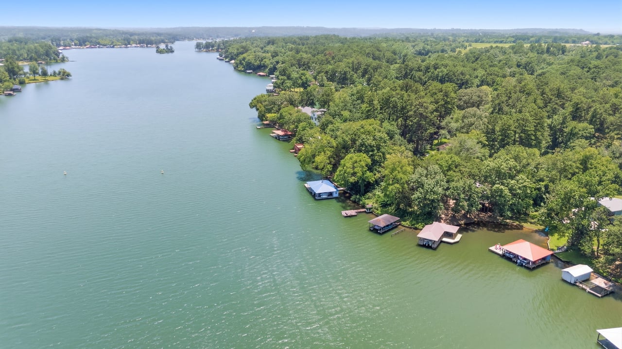
When you stand on that exposed slope, you are probably not standing on the lot you would buy. On most Lake Fork waterfront, the deed stops short of the water. The ground between the lot line and the lake belongs to the Sabine River Authority, and the dock built on that ground stays there under a permit. If you are buying Lake Fork waterfront this season, the low water has made that permit easy to see, and it deserves the same attention you give the house.
The deed and the dock usually sit on different ground
The Sabine River Authority's Lake Fork Rules and Regulations, approved by its board in June 2025, set the conservation pool at 403 feet above mean sea level. They also say the lake can rise beyond that and flood land up to a Project Boundary at 412 feet. The rules describe that boundary as generally following the 412-foot contour or running at least 200 horizontal feet from the 403-foot line. They then add that the boundary "is actually a metes and bounds description." The SRA calls the land between that boundary and the conservation pool the Floodplain.
If you own land next to the boundary, you can apply for a Limited Use Permit covering the Floodplain in front of your property. A private homeowner's version is called a PLUP. Under the rules, the adjacent owner gets first option on that use, as long as they agree in writing to the rules, the fees and a waiver of damage claims against the SRA. Docks, piers, wharfs, boathouses and ramps can be built inside the permit area, but only after the SRA approves the construction plans in writing.
Next, the rules address water levels directly:
"The SRA is under no obligation to maintain a specific level of the Reservoir in order to facilitate the construction or use of any structure provided for herein."
That is Section 27.2. The section after it lets the general manager limit construction, operation and maintenance of improvements when lake levels change. Section 27.4 says a permit will "generally" give some access to the lake at conservation pool. At the back of coves and in narrow inlets, though, access is provided only where the SRA decides it is reasonable and practical.
So a cove lot with a deep-water dock in a spring listing photo comes with a few facts the photo can't show. The SRA owns the land under the dock. The SRA approved the dock. And the SRA has said in writing that it doesn't promise water under it.
What five feet looks like on the record
A gauge reading is useful mostly because you can compare it with earlier readings. Here is Lake Fork's slide across 2026, using the board's own comparison dates:
| Date | Mean level (ft) | Percent full | Surface area (acres) |
|---|---|---|---|
| Oct. 30, 2025 | 400.86 | 90.8% | 24,945 |
| Apr. 30, 2026 | 400.46 | 89.2% | 24,581 |
| Jul. 30, 2026 | 400.17 | 88.0% | 24,318 |
| Sep. 30, 2026 | 398.40 | 81.1% | 23,335 |
| Oct. 30, 2026 | 397.93 | 79.3% | 23,079 |
Most of this year's drop came after midsummer. The lake held above 400 feet through July and then lost more than two feet by the end of October. The board notes that percent full is measured against conservation capacity and leaves out storage in the flood pool. The 403-foot line is the right yardstick for a dock, because it is the level the SRA's access language refers to.
For you as a buyer, the useful part of the table is that today's level is a free test. A dock that still floats, still reaches water a boat can use, and still has a clear path out of its cove at 397.9 feet has shown you something no listing description can. A slip that is sitting on mud tells you something too. The permit area doesn't move when the water drops, and neither does the SRA's position on lake levels.
Why the lake's level has other claimants
Lake Fork is a water-supply reservoir, and the SRA's drought contingency plan lists who holds contracts on it. The City of Dallas has 120,000 acre-feet under contract. Longview has 20,000, Kilgore 6,721, Henderson 5,041, and Bright Star Salem SUD 840. The plan says seven firm-contract entities in the Lake Fork Division together have authority to divert up to 157,222 acre-feet a year. Separately, a 2025 City of Dallas council item describes the North Texas Municipal Water District's own Lake Fork contract for 20,000 acre-feet a year. That water travels through the Dallas Water Utilities Lake Fork Pump Station and pipeline to Lake Tawakoni.
Those figures are contract amounts, so they don't tell you how much any city pumped this year. What they show is the order of priority. The permit rules put that order in writing even for small uses. If a homeowner gets approval to pump raw lake water for non-household use, they are limited to a single electric pump with a discharge line no wider than one inch. The rules also make that use subordinate to every present and future municipal, industrial, mining and irrigation supply agreement the SRA signs. Lake Fork's level depends on rain, heat and contracts that were in place before any particular dock was built. The year-over-year table above reflects all three.
What the permit file should answer before closing
Because the dock sits on SRA land under a permit issued to a named applicant, a buyer's diligence has to include an office in Quitman along with the inspector's report. The PLUP application asks for the applicant's name, the subdivision and lot or a deed description, and whether there's a septic system. It's returned to the SRA together with a warranty deed. The form doesn't say what happens to an existing permit when the house sells, and the SRA's published materials don't set out a transfer procedure or a transfer fee. Ask the Lake Fork Division office directly how a change of ownership is handled before you rely on any assumption.
These are the questions worth putting to the SRA, the seller and your own advisors during the option period:
- Is there a current PLUP, and in whose name? Using SRA land without a permit or other written approval counts as trespass under Section 27.6, and it can count against a later permit application.
- Was each structure approved in writing? That includes the dock, the boathouse, any ramp, and any seawall or path down the bank. The construction rules require written approval before work starts. The SRA's July 2025 PLUP construction application puts the cost of bringing improvements into compliance on the permittee.
- Has anyone cleared, dug or reshaped the bank? Section 27.5 bars digging, scraping, channeling, moving earth, or removing trees and vegetation inside the Project Boundary without written approval. The SRA can require the land to be restored within 30 days and charge a retroactive fee. An exposed bank makes it tempting to clean things up, so ask about work done this season as well as in past years.
- Are there open violation notices? The SRA gives 30 days' written notice to correct a violation. If it isn't fixed by day 31, the permit is terminated, the owner has to reapply, and any grandfathered provisions are lost.
- Where exactly is the permit area? Each permit defines its area directly or by reference to maps kept at the Lake Fork office, and the SRA has the sole right to set and revise those boundaries. The waterline you see this week doesn't show you the boundary.
The permit fee is small next to everything else. The SRA's application form, last revised in 2022, lists the annual fee as $40 plus five cents per running foot of Project Boundary next to the property, prorated to an August 31 anniversary. At that rate, 150 feet of boundary would come to $47.50 a year, but the rules refer to a separate current fee schedule, so confirm the amount with the office. A dock construction application carries a $50 fee. The Lake Fork office is at 353 PR 5183 in Quitman, phone 903-878-2262.
This is general information, not legal or financial advice. Permit questions in a contract belong with your attorney, your title company and the SRA itself.
For sellers, the low bank works in your favor
If you're listing a Lake Fork home this winter, buyers will see your shoreline at its most revealing, so have the permit paperwork ready before the first showing. That means the current PLUP, the written approvals for each structure, and any SRA correspondence. A dock that has been properly approved is private property, and the permittee can restrict public access to it. The one exception is that the public may still cast into those areas to fish. Being able to show clean approvals answers the question a careful buyer will ask this season. Photos and aerials taken at the current level, set beside images from a fuller lake, show honestly how the dock performs across the range.
Quick answers
Does the SRA's October fee proposal affect homeowners? The SRA's October 6, 2026 notice covers draft fees for Commercial Limited Use Permits, and comments are open through November 6. Any change takes effect only if the SRA board adopts it.
Can a cabin or RV go on the permit area? No structure meant for living in, including houses, manufactured homes and RVs, may be placed on SRA land without written approval. Full-time living there isn't permitted unless the SRA specifically approves it.
Can SRA staff come onto my lot? Yes. By signing a permit, the permittee agrees to let SRA personnel cross private land to reach the Floodplain for inspections.
If you're weighing a Lake Fork dock while the water sits five feet low, I'd be glad to walk the shoreline with you and put together the permit questions for the Quitman office before your option period starts. Britany Ott can help you compare what the deed covers with what the permit allows. Let's Connect.